

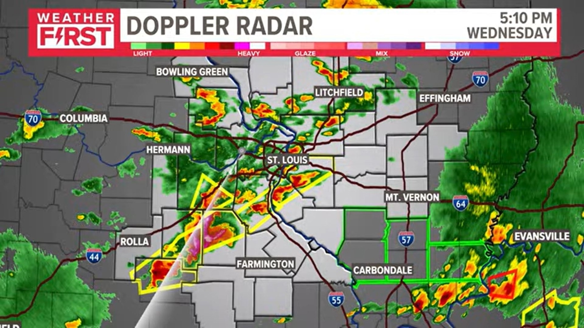
ST. LOUIS — A second line of strong storms is moving through the southern part of the St. Louis area, resulting in weather warnings and watches.
A tornado warning was issued for Iron County, Missouri, in Missouri until 9:30 p.m. The warning has expired for Iron County.
A tornado warning expired at 7 p.m. for Monroe and Randolph counties in Illinois and Ste. Genevieve County in Missouri. The National Weather Service in St. Louis said the tornado was radar-indicated and has not been confirmed on the ground.
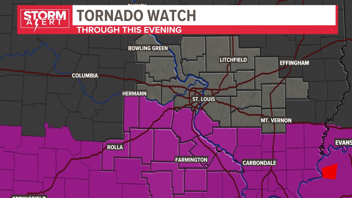
A tornado watch remained in effect until midnight for several counties south of St. Louis.

A severe thunderstorm warning was in effect for Bond, Clinton, Madison and Montgomery counties in Illinois and Washington County, Missouri.
Flash flood warnings were issued for Jefferson and Phelps counties in Missouri. The warning in Jefferson County runs through 9:15 and the warning in Phelps runs through 11:15.
Water was rushing Wednesday afternoon along Interstate 44 near Highway 50 outside of Union. Traffic was moving, but slowly, as emergency vehicles were on the scene dealing with the flooding.
The severe weather caused Scott Air Force Base to release non-mission essential personnel from the base and a delay for the St. Louis Cardinals game.
The Weather First Team has issued a Storm Alert for Wednesday due to the potential of strong to severe thunderstorms. There is a higher potential for more widespread, high-impact severe weather across the 5 On Your Side area than the past few days.
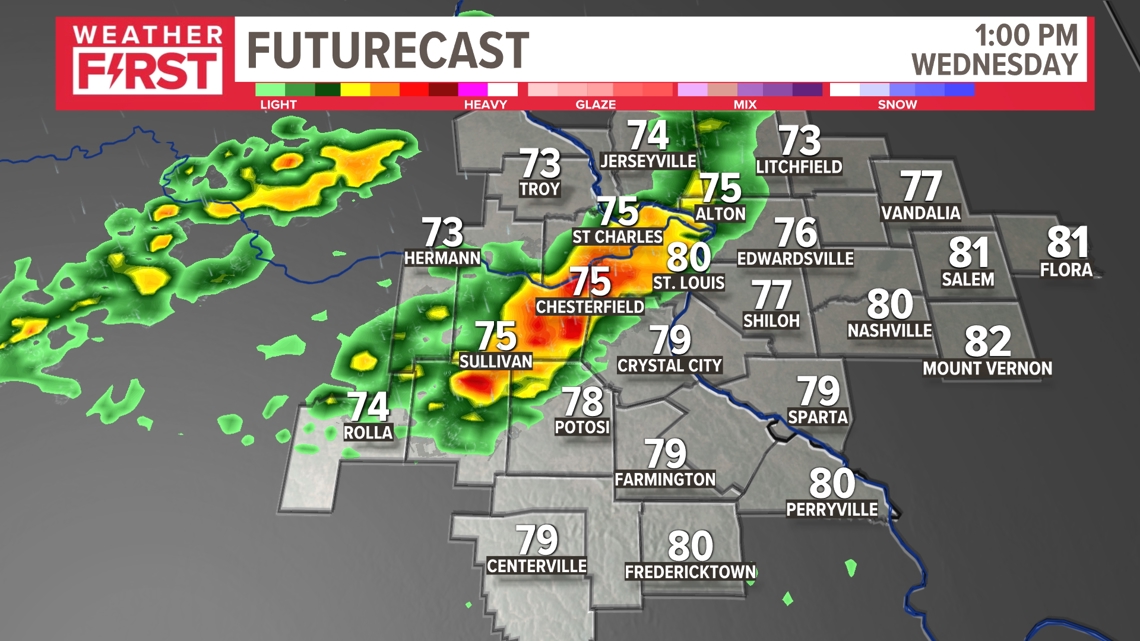
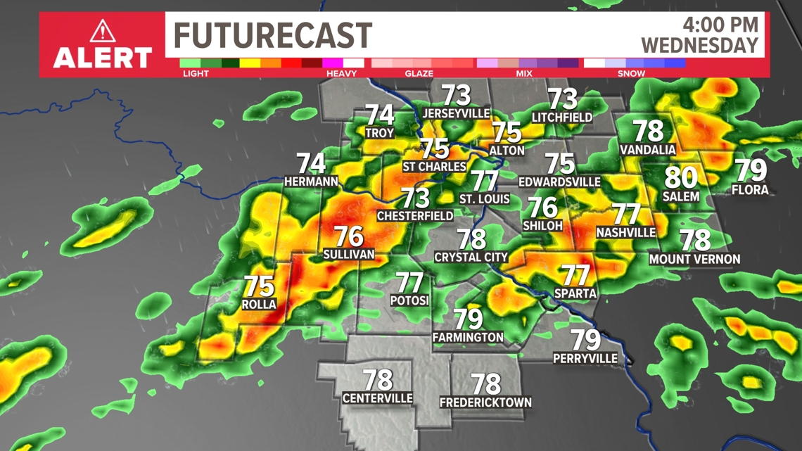
The threats appear to be hail larger than golf balls, wind gusts in excess of 70 mph and a few strong tornadoes. Storms are expected to develop around 10 a.m. in our western counties and drift into the metro area closer to lunchtime. The strongest storms will impact our southern counties with a level 4, moderate risk. The threat will clear the area late Wednesday night.

Numerous strong to severe thunderstorms are likely Wednesday from around lunchtime through dinner time. Make sure you know where to go in the event of a tornado, especially if you'll be at work.
The best chances for severe thunderstorm development will be during the afternoon hours when widespread instability will be available.

Areas that don't see an rain from the first round, mainly farther south of St. Louis, may have a higher chance of late day severe weather.


The cold front should sweep through the area Wednesday night providing a break from this active weather pattern as we head into Mother's Day weekend.
Have several ways to receive warnings on Wednesday as these storms develop.
Download the free 5 On Your Side app to get the latest watches and warnings and track conditions live with our interactive radar. Use the links below to download now.
5 On Your Side news app
iPhone | Google Play
The Weather First Team will use "Storm Alert" to refer to life-threatening or major-impact weather conditions in our region. "Weather Alert" refers to nuisance or disruptive weather and is indicated by orange icons and bars in our weather graphics on TV and online.
