
ST. LOUIS — A tornado watch has been issued for Clay County through 8 p.m. as the St. Louis region recovers from a storm system early Tuesday morning.
Tornado warnings expired for parts of St. Charles, St. Louis and Calhoun counties at around 5 a.m. Earlier tornado warnings were allowed to expire for Crawford, Franklin and Washington counties after a line of strong storms moved through the area.
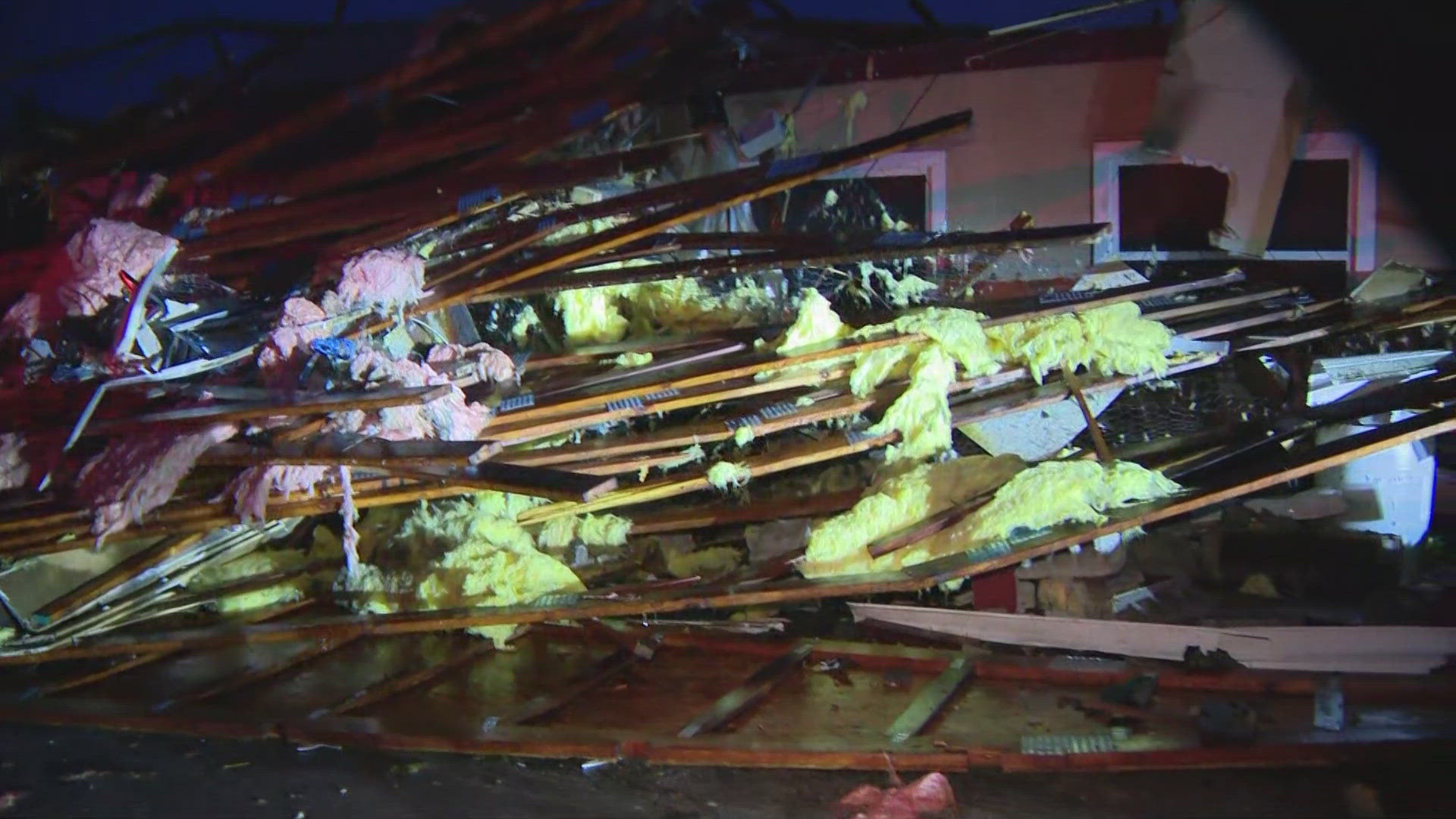
Officers with the Sullivan Police Department are responding to calls of damage. The department confirmed that One More Pub & Grub was heavily damaged by the storm. The bar was previously known as Hilltop Lounge.
Emergency management in the area also said Sullivan High School was damaged by the storms.
As of 6:30 a.m., there were about 1,400 power outages reported in Missouri. Click here to track outages.
Those storms clear away late morning with dry weather returning by Tuesday afternoon. There is only a slim chance east and southeast of St. Louis of an isolated strong to severe storm possible. The better chance for afternoon thunderstorms will be farther east into the Ohio Valley.
Round two will slide in on Wednesday and bring more "fuel" or instability for strong to severe storms. There is a higher risk for severe weather in our area by then. Most of the storms that form will do so in the afternoon and evening hours.


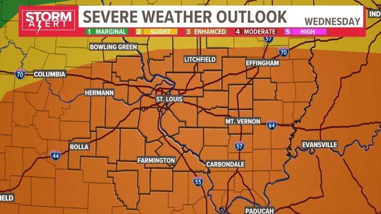
Right now, the entire 5 On Your Side viewing area has an enhanced risk for severe storms. That's a level 3 on the Storm Prediction Center's severe weather scale. This means that numerous severe storms are possible then.


For comparison, this morning's storms were part of a marginal/slight risk. So this is a greater risk than what we dealt with today. Tuesday's storms will be a good test for your storm plan as we prepare for another more significant round of severe weather on Wednesday.

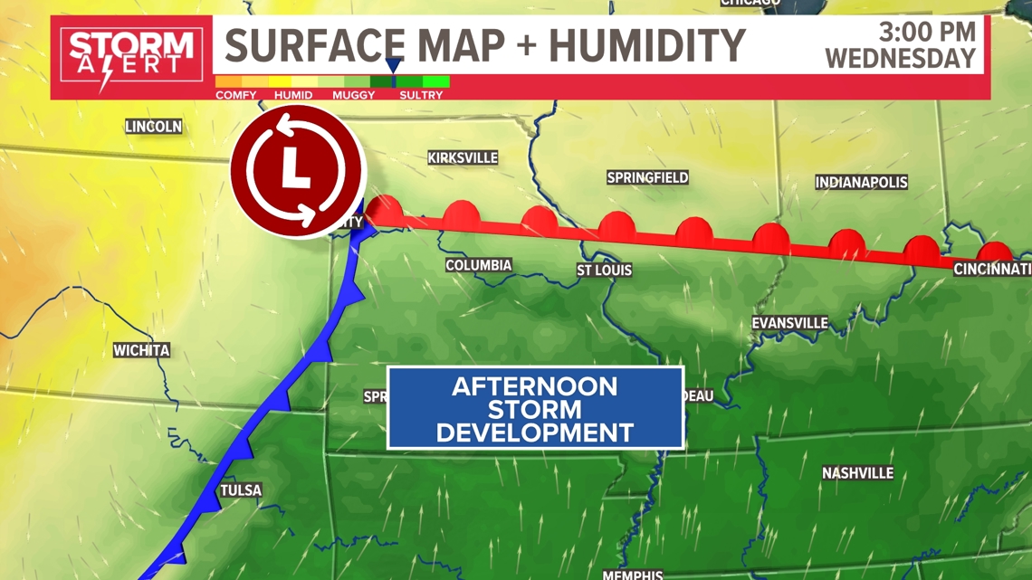
Our severe weather threat will hinge on the movement of this warm front to the north. Significant humidity and instability will build here before the cold front moves in and storms fire up during the late morning and early afternoon hours.

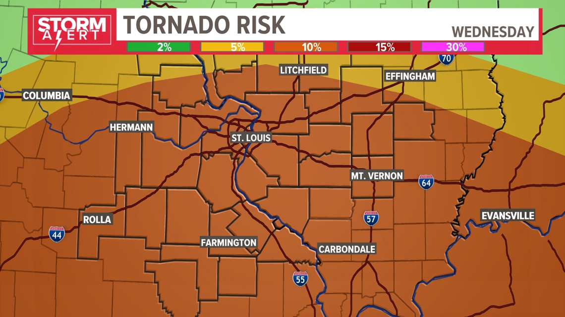

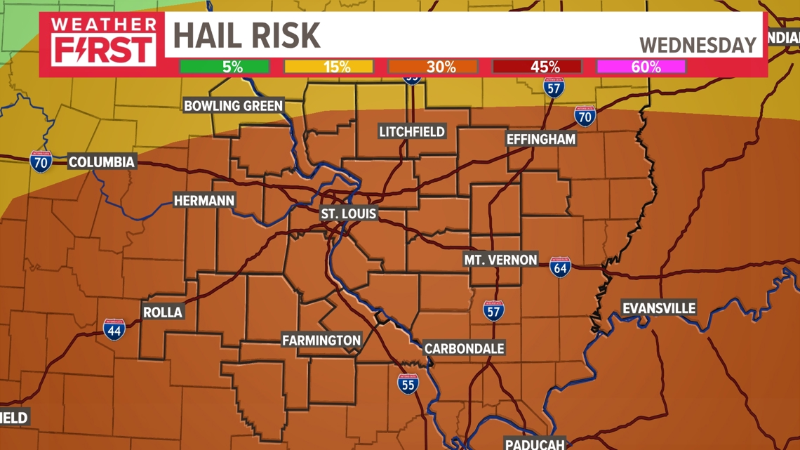
We have been highlighted under a significant risk for large hail and tornadoes on Wednesday as well.
Make sure you have a way to receive weather warnings on Wednesday morning and evening.


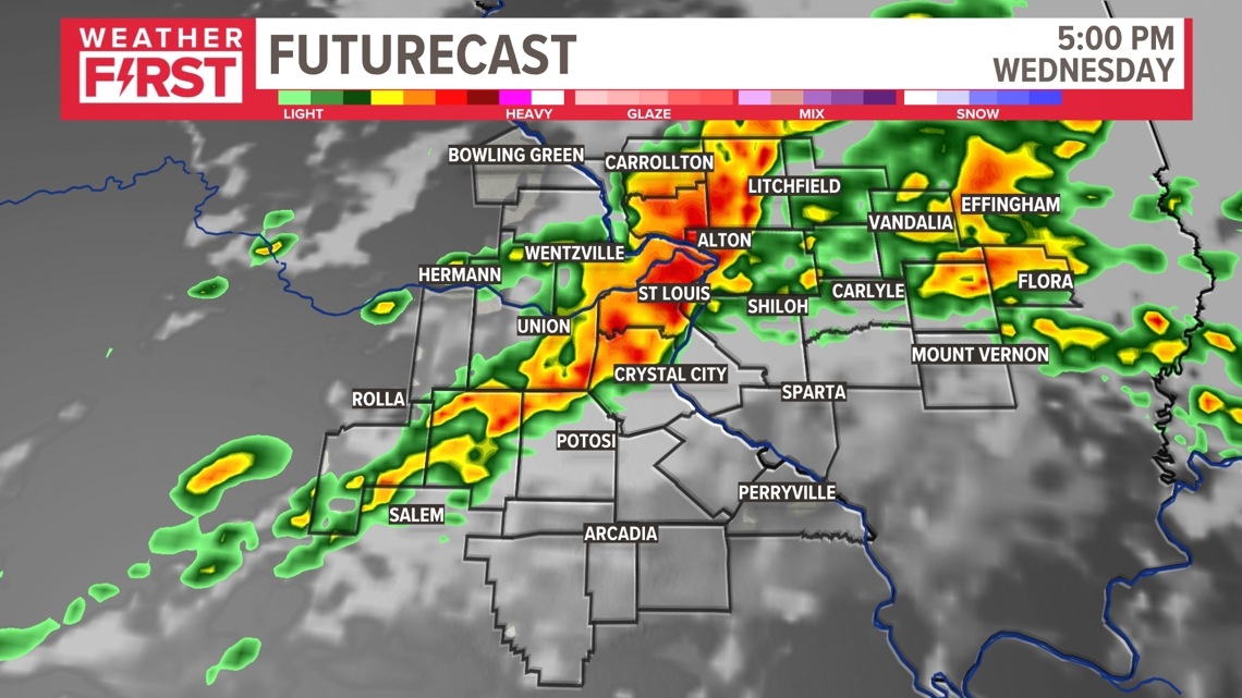
Storms may fire as early as late morning Wednesday. This threat will continue through the afternoon as well.
Thunderstorms Wednesday afternoon have more of the severe weather ingredients to work with and should be able to create more widespread strong to severe thunderstorms.


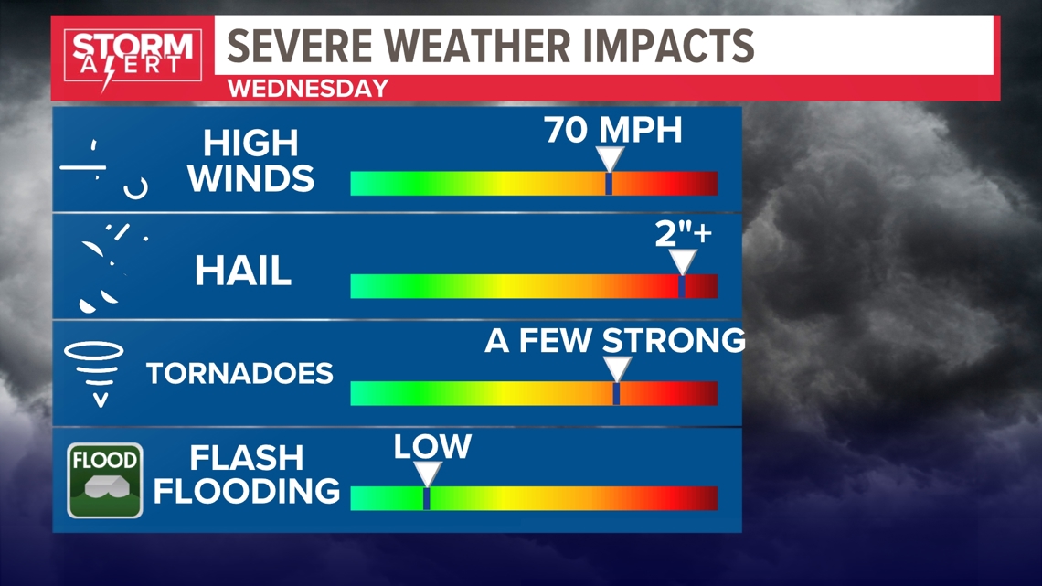
Some of our main threats include wind gusts up to 70 mph, large hail, and tornadoes. Hail over 2" and a few strong tornadoes seem to be the main threats as we look at the ingredients coming together. Pay attention to the latest updates as we prepare you for what seems to be a more significant severe weather threat.
Download the free 5 On Your Side app to get the latest watches and warnings and track conditions live with our interactive radar. Use the links below to download now.
5 On Your Side news app
iPhone | Google Play
The Weather First Team will use "Storm Alert" to refer to life-threatening or major-impact weather conditions in our region. "Weather Alert" refers to nuisance or disruptive weather and is indicated by orange icons and bars in our weather graphics on TV and online.
