
ST. LOUIS — St. Louis is not quite ready to say goodbye to summer — at least for a few days.
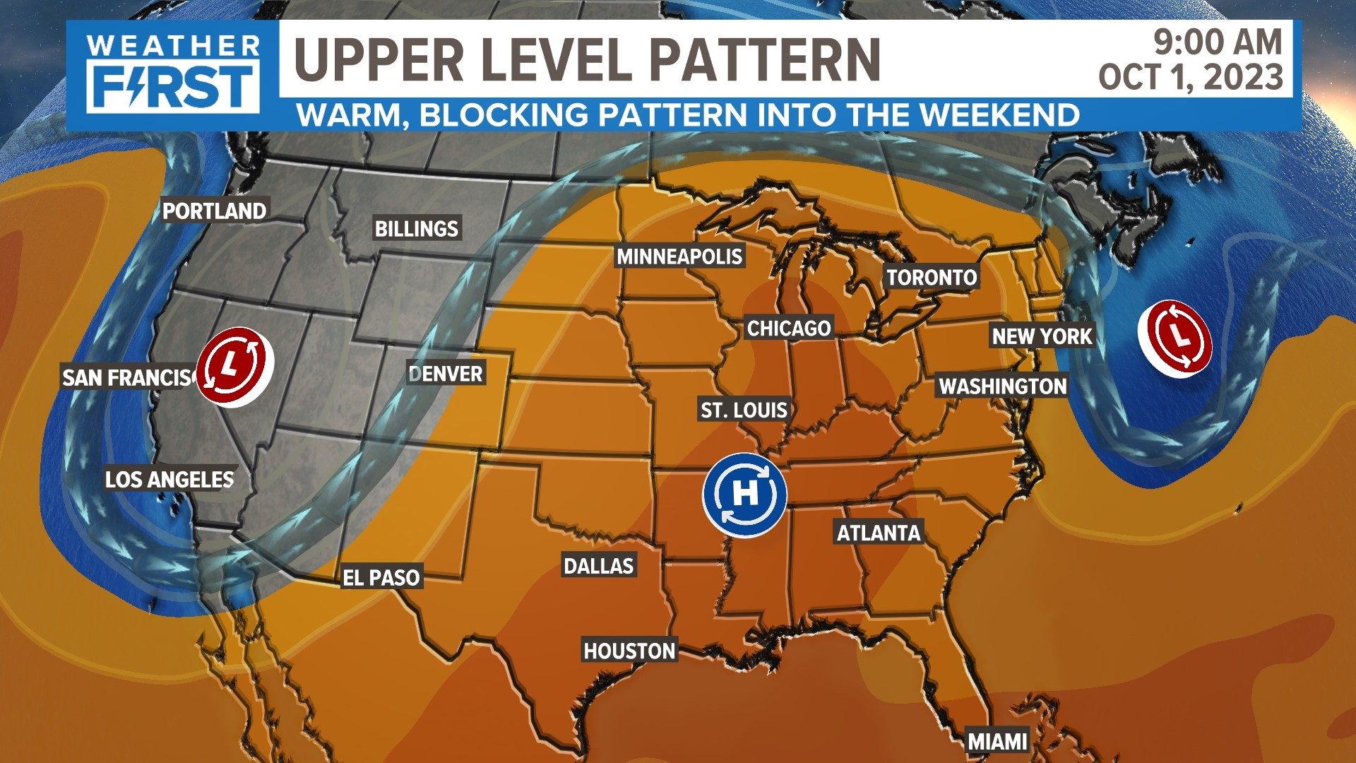
Starting Thursday into early next week, an 'Omega Block' will be building into our area. This large upper-level pattern will bring dry conditions and well above average-temperatures.
The weather pattern, which gets its name from its resemblance to the Greek letter omega (Ω), is creating a low-high-low weather pattern over the country, with the central U.S. in the area of high pressure. Under this area of expansive upper-level high pressure, the air is sinking. Sinking air means warmer than average and mainly clear skies.
Temperatures for the past several days of September have been well above the 30-year normal values. The high on Tuesday in St. Louis was 90 degrees. After Tuesday night and Wednesday night storms, the pattern begins to shift with the upper low responsible for the showers and storms moving to the east as the large upper high builds over the Bi-state by the weekend.
This will bring a return to near 90-degree temperatures to end the month of September and begin the month of October.
Temperatures in the St. Louis area will stay well above average for this time of year right into next week. The average high temperature for Oct. 1 in St. Louis is 75 degrees.
The blocking pattern will break down as we head into the second week of October, likely bringing more typical fall-like weather back to St. Louis.