


ST. LOUIS — This type of cold is something we expect to be a little bit more common now that we're well into the month of November, but it's about to get even colder over the next few days. So much so, that it would be below average for the month of January!

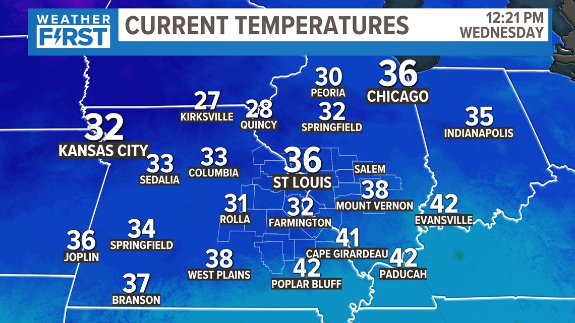
Temperatures have been on the colder side over the last few days, but we've managed to get into the 40s, even after snowfall. We're monitoring another surge of Arctic air that's poised to impact us by Friday.

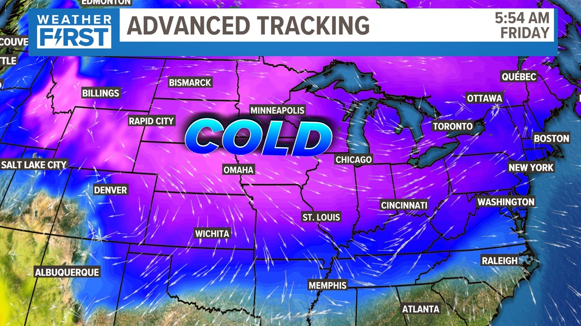
This Arctic air surges south and impacts most of the Midwest...and beyond. Friday looks to be the coldest overall day, but temperatures in the morning over the weekend are also expected to be the coldest of the season as well.

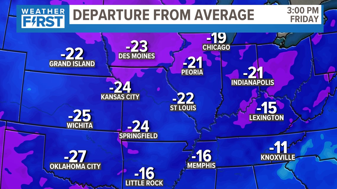
To put this in perspective, our average high temperatures this time of year range in the low 50s. We'll be some 15 to 25 degrees below normal throughout the entire region.

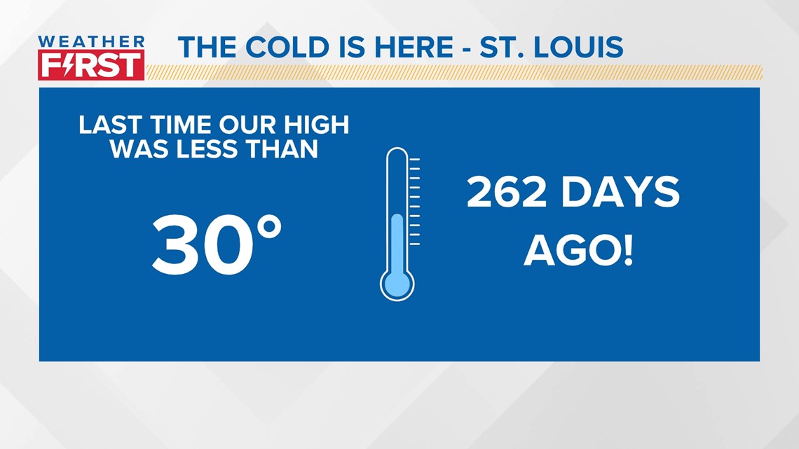
The last time we had a high under 30 degrees was in February. That's how significant this surge of cold air is for this time of the year.

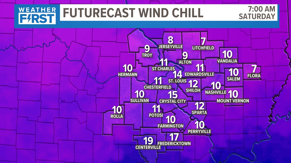
Wind chills on Saturday morning could be in the single digits briefly as we start off in the teens to begin Saturday and Sunday. The good news? Temperatures look to get closer to normal by the holiday week.
