
ST. LOUIS — It's been a very mild start to the month of November so far. Not only are our daytime highs above average, we really notice it in the morning when temperatures are remaining in the 40s and 50s in many cases.
That's all set to change, to some degree, as we track our next cold front north of the border. It's significantly colder there, but I don't think all of that reaches us for this particular system.
This afternoon, there is a severe weather threat well southwest of here. At this point, I don't see any reason this should impact us in any way. The timing of the system and several other ingredients aren't quite favorable for severe weather in the general sense. But I wouldn't be surprised to see one of these thunderstorms generate a brief 60 mph wind gust since it's already so windy. That would be the extent of it.

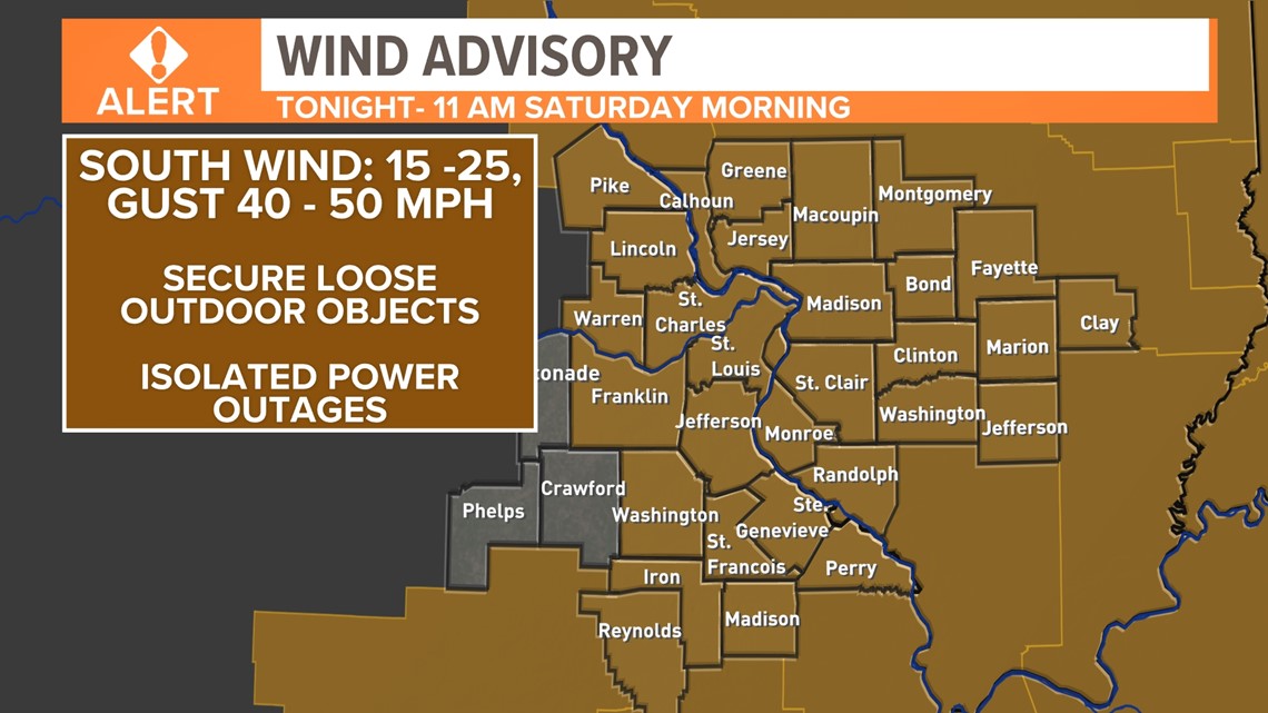
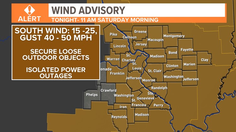
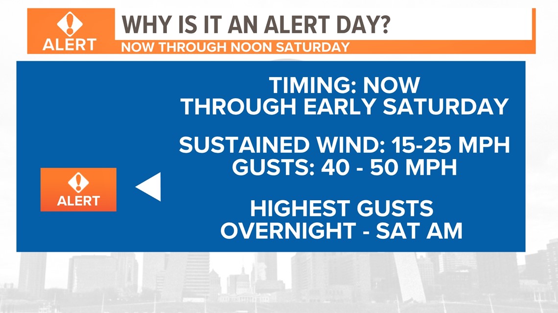
Expect high wind to continue be an issue tonight into early Saturday as this front draws nearer. Wind gusts between 35 and 50 mph are quite possible during this timeframe. Most of our area is under a wind advisory late tonight through 11 AM Saturday.

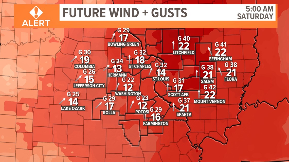
Most of today looks dry, but we are in a Weather Alert for late tonight into Saturday morning because of higher wind gusts and brief, heavy rain. Notice that sustained wind out of the southwest will be around 20 mph.
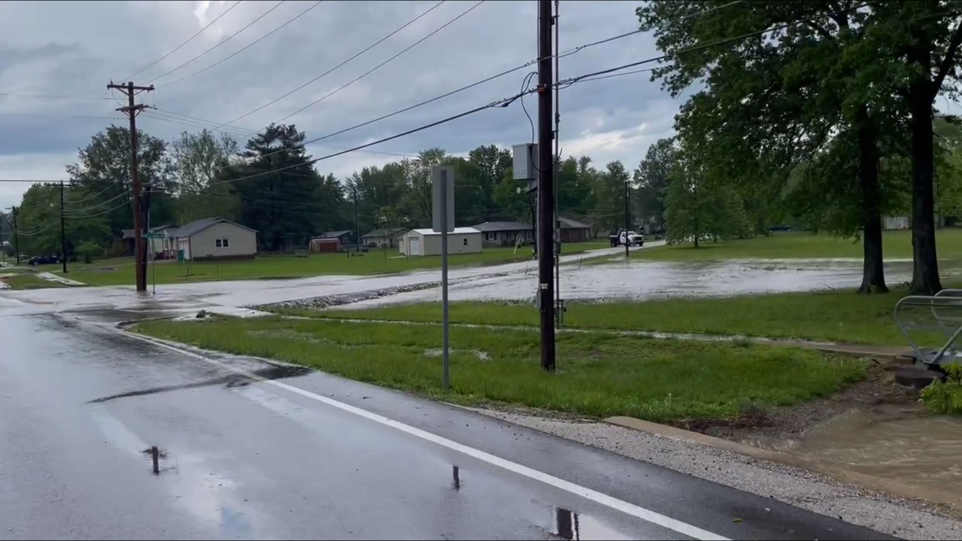
The wind remains a huge factor into the overnight hours as the front itself finally moves through. Temperatures will gradually fall as steady rain and a few thunderstorms are expected as the front pushes through our area.

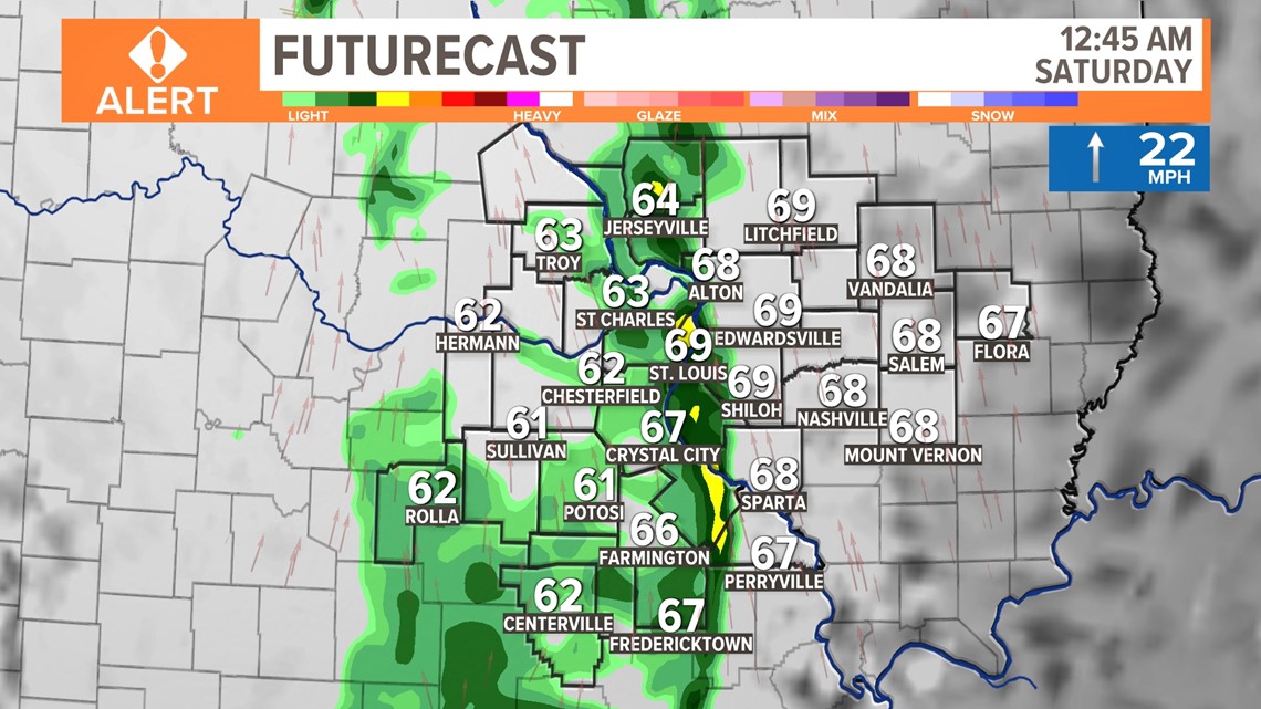
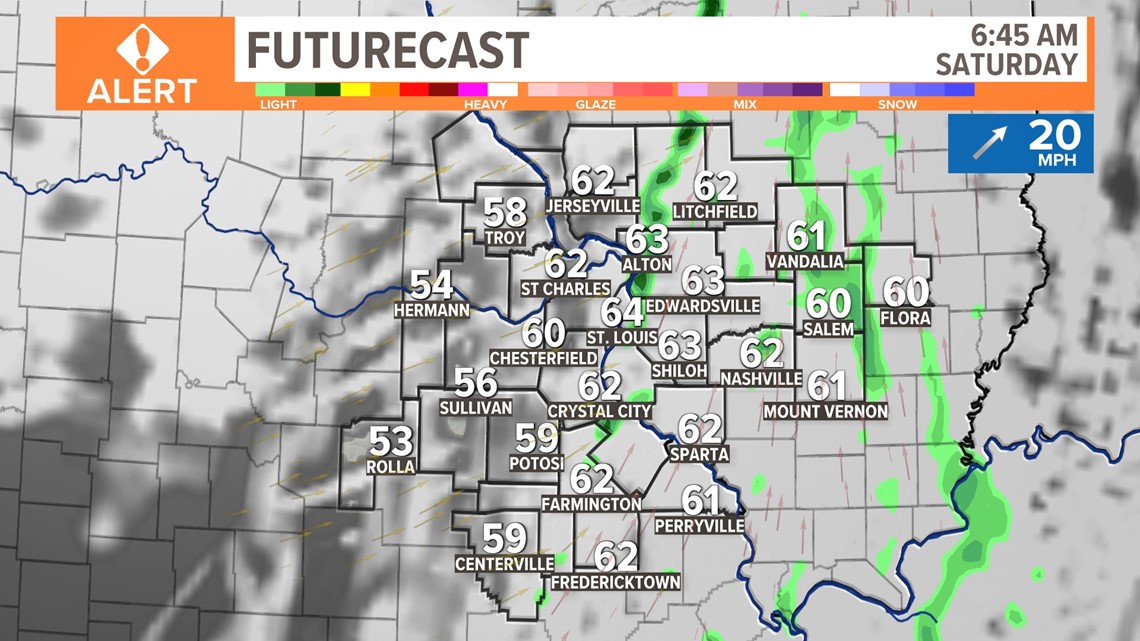
In the pre-dawn hours of Saturday, a few light showers can be expected, but they will mainly be on the Illinois side. Temperatures will continue to fall for about 2-4 more hours before rebounding in the afternoon. Wind gusts are expected to remain around 30 mph before gradually dying down.

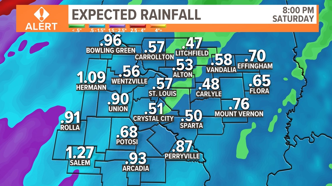
We can expect somewhere between half an inch to an inch of total rainfall by midday Saturday. A few areas that get stuck under thunderstorms Friday night may catch a total of around one-and-a-half inches on the higher end. Things rebound quickly Sunday and to start the week before some colder weather is on the horizon.

Download the free 5 On Your Side app to get the latest watches and warnings and track conditions live with our interactive radar. Use the links below to download now.
5 On Your Side news app
iPhone | Google Play