ST. LOUIS — Update at 6:40 p.m. The threat of any severe weather is diminishing with the loss of daytime heating. Scattered damage reports and power outages have been reported as gusty winds in one storm that moved from St. Clair county in Illinois into the City of St. Louis and St. Louis and St. Charles counties.
An area of low pressure is spinning just to our southwest and is kicking up showers and storms.
A severe thunderstorm warning was in effect Wednesday evening for parts of the St. Louis area, but was later canceled. The storm caused about 8,000 power outages in the St. Louis area, according to the Ameren outage map.
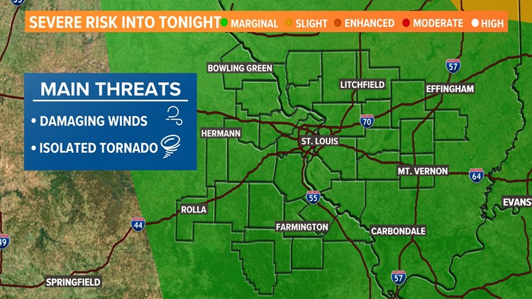
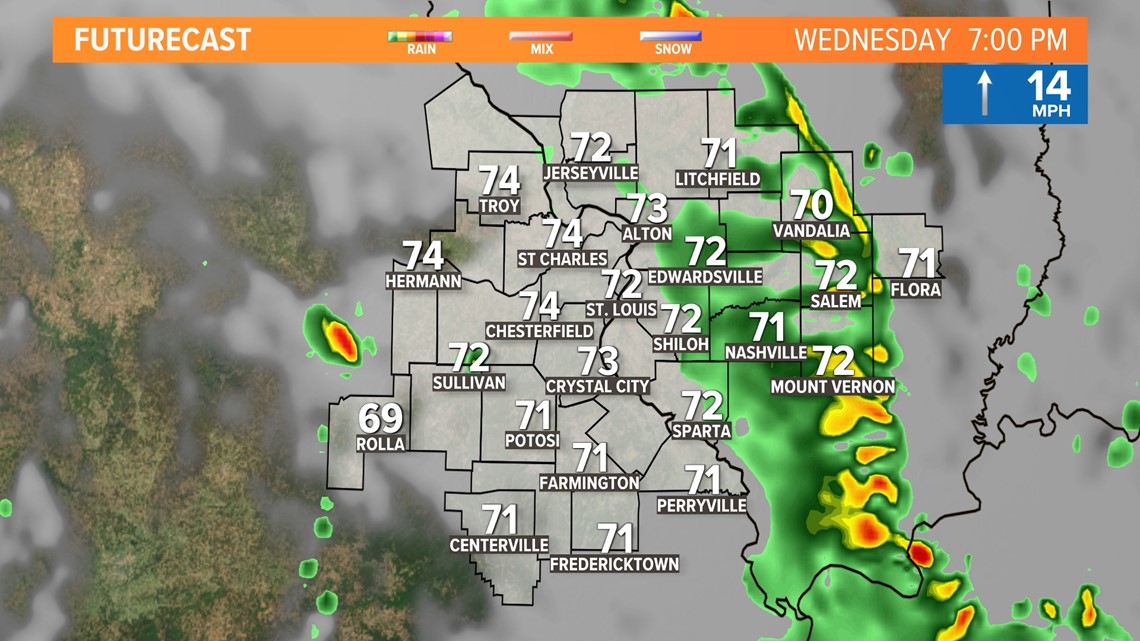
The overall threat for severe weather is low, but nonetheless a threat. Main risks will be damaging winds more than 60 mph an isolated brief tornado possible, mainly on the Illinois side of the river.
The timing of the worst weather will be from 3 to 7 p.m. Wednesday.
The graphics below the forecasted progression of the storm during those hours, which could impact the evening commute.

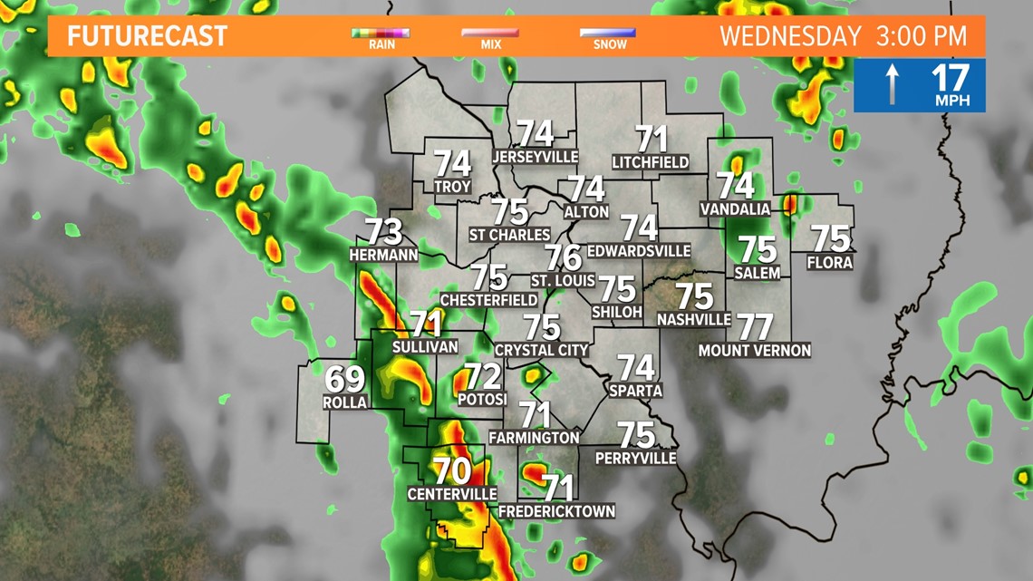
The broken line of thunderstorms could have some gusty winds. Clouds and earlier showers are limiting the instability and thus limits the strength of the storms.

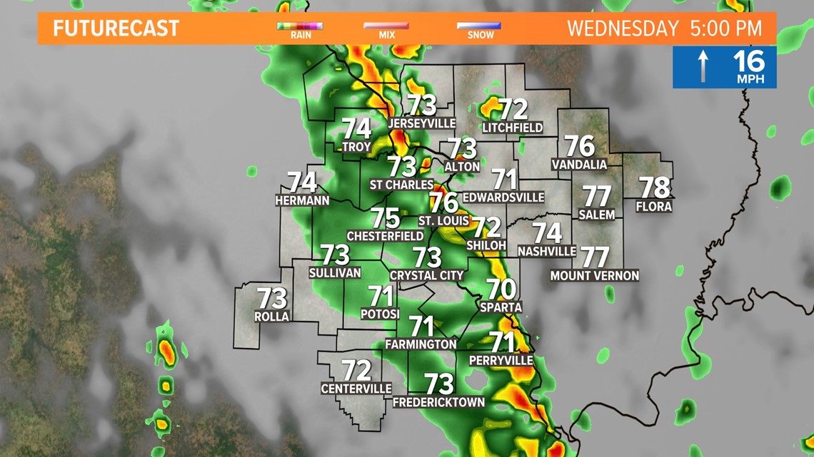
Any threat of severe weather should shift east into Illinois through the evening hours.

Download the free 5 On Your Side app to get the latest watches and warnings and track conditions live with our interactive radar. Use the links below to download now.
5 On Your Side news app
iPhone | Google Play
After Wednesday evening, the severe weather risk will diminish, but the rain and thunder will continue on and off through Thursday. Any thunderstorm that develops on the Illinois side of the river Thursday could have some brief gusty winds, but widespread severe weather is again unlikely.
As the system moves away from us on Friday, clouds will be slow to clear and there still could be a few showers in the morning with mainly cloudy skies.
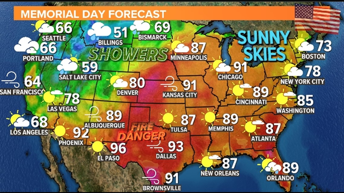
The weekend turns hotter and humid with highs climbing near 90 degrees by Sunday. Dry weather will continue into Memorial Day with lower 90s expected.

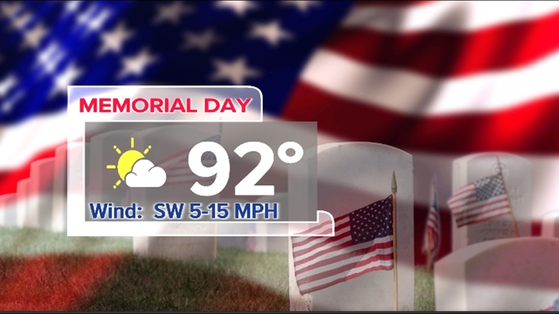
The rest of the country's forecast for Memorial Day is a dry one, but also warm. In fact, high temperatures will push into the 90s to near 100 in parts of Texas with a high fire danger there. Most of the central plains should stay dry with the rain confined to the northern tier states. Nice and dry along the eastern seaboard and comfortable and dry along the West Coast.