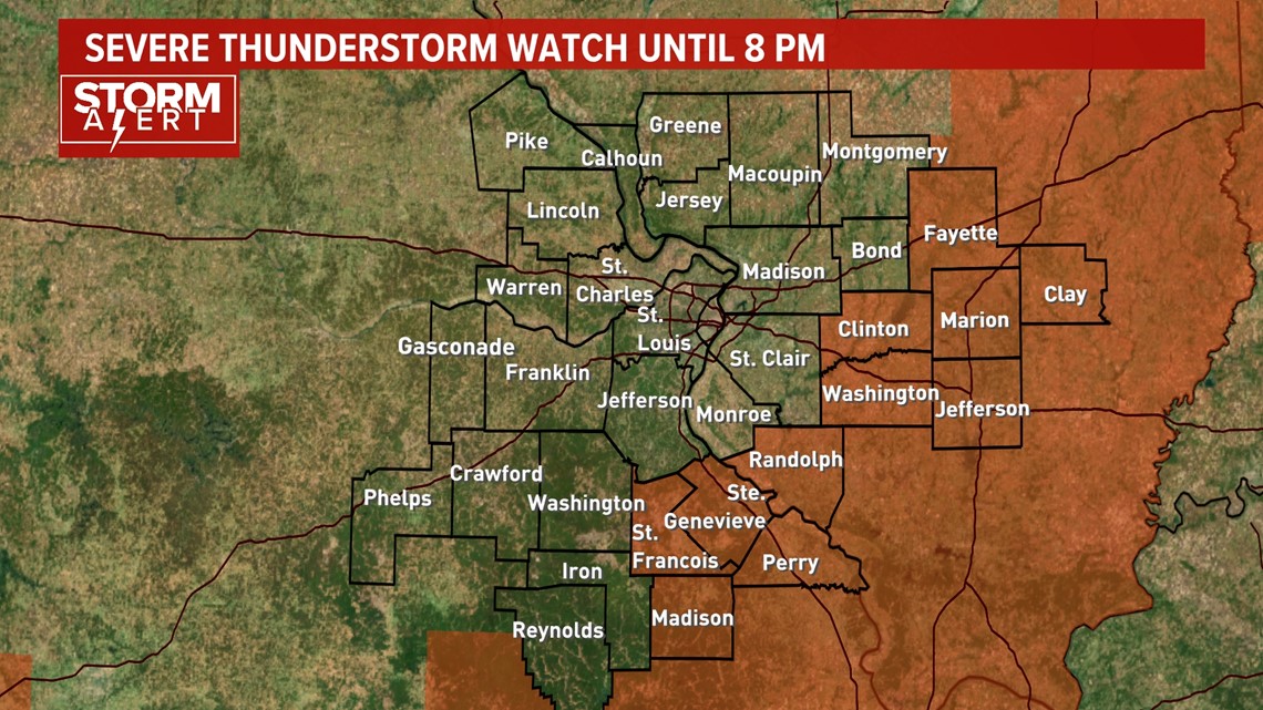
ST. LOUIS — Update: The threat of severe weather has shifted to far southern and eastern portions of the 5 On Your Side area. A severe thunderstorm watch is in effect for those areas until 8 p.m. tonight. Hail has been and will be the main threat, up to the size of quarters.

Previous story:
Spring is usually a busy time for severe weather. We're gearing up for another round of strong storms today.
The morning is off to a dry start, but the main event will arrive after lunchtime. The Storm Prediction Center has most of the 5 On Your Side coverage area under a slight risk for severe storm development.
If these storms grow to meet severe threshold, strong wind gusts will be an issue. There could also be areas of large hail, similar to what came down the past few days.
Thursday, multiple counties saw large hail. Reports and radar readings measured quarter to golf ball-sized hail from Pike County, Missouri, over to Phelps and Crawford counties.
Mindy Richards near Steelville, Missouri, took this photo of the larger than quarter-sized hail during a severe thunderstorm just before 6 p.m.


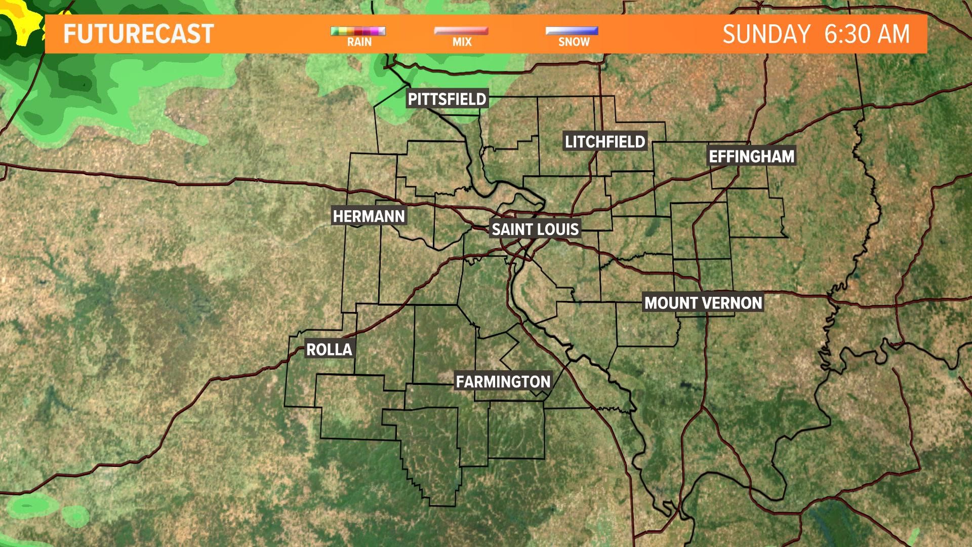
Large hail is possible again Sunday. There will be spots were downpours are heavy. Rainfall could quickly overwhelm creeks and runoff areas. Brief ponding could be treacherous for drivers.
The current forecast is below depicting approximate timing and location for Sunday's storms.