ST. LOUIS — A massive storm system will spread across the middle part of the country and deep south Wednesday into Thursday. In the colder air, snow is expected while flooding rain and severe weather are possible farther south in the warm sector of the storm.
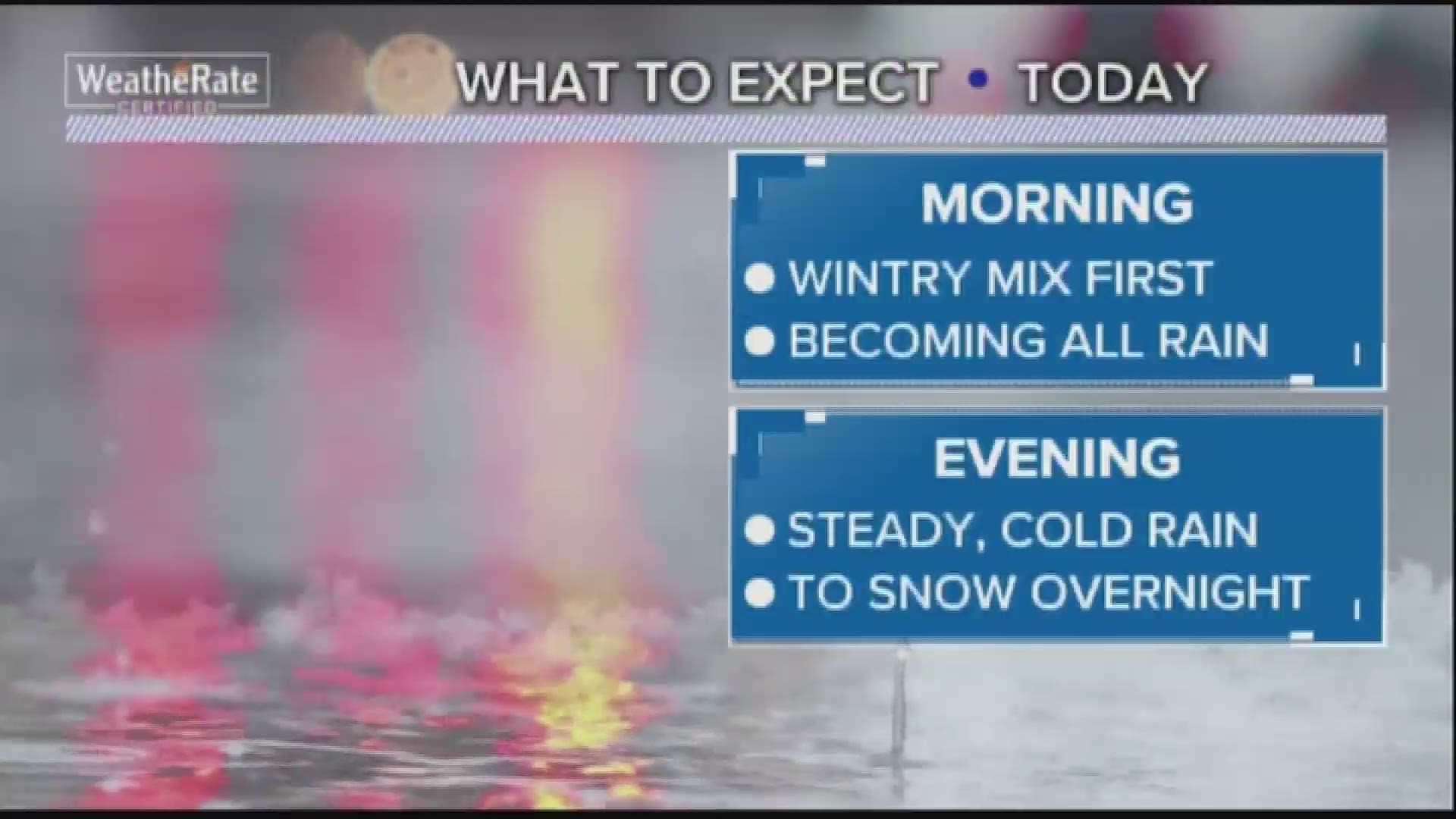
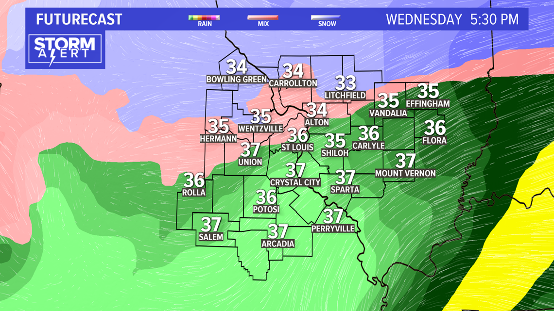
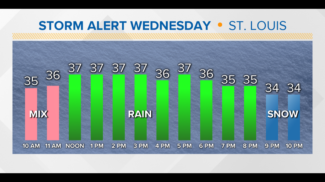
After highs in the 40s on Tuesday in St. Louis, temperatures will drop to around freezing by Wednesday morning. An area of moisture will be surging north during the early morning hours, mostly as rain. The leading edge will likely be snow or a rain-snow mix for the first hour or two in the metro while areas farther north will likely stay mostly snow.

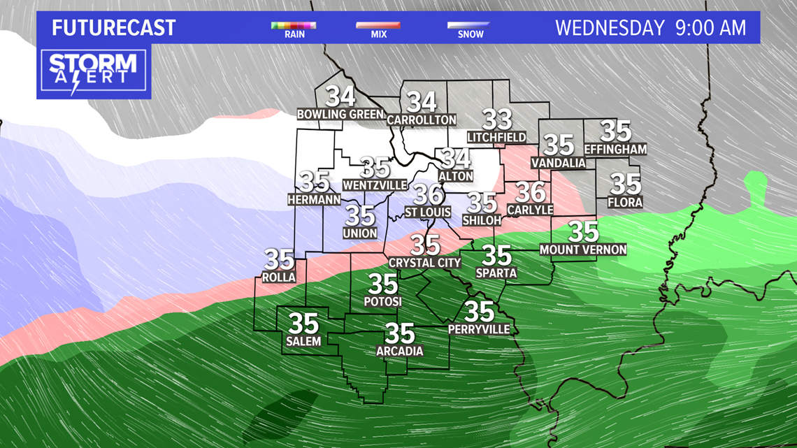
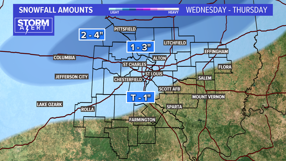
In Missouri, the snow line should be north from Montgomery, Lincoln and Pike counties, and In Illinois, north of Calhoun, Greene, Jersey, Macoupin and Montgomery counties. Those places could get up to 1-4 inches.
RELATED: Live interactive radar
By midday, the cold rain should cover the metro area and points south.

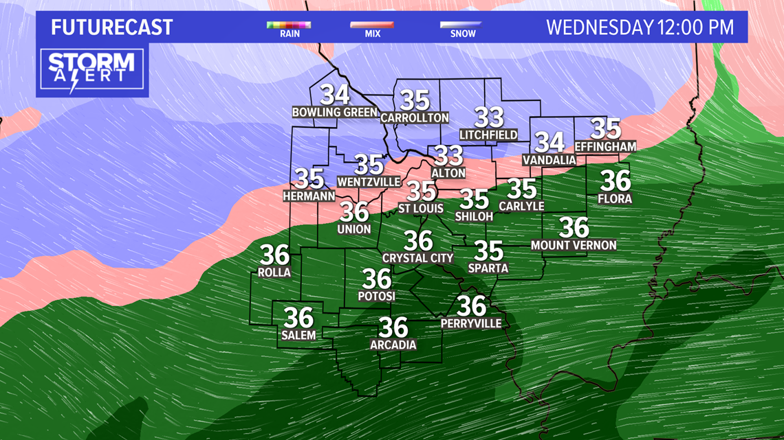
During the evening, the winds will turn to the northwest, allowing colder air to move to the southeast changing the rain back to snow for a time across the metro area.
Download the 5 On Your Side app to track the wintry weather with radar and get the latest updates for your area:
5 On Your Side news app
iPhone | Google Play

The snow will taper off late Wednesday night to just flurries by early Thursday morning. The greatest accumulation will stretch from central Missouri into central Illinois where three to five inches of snow will fall. Amounts will drop off quickly as you travel southeast from the heavier band with trace amounts to an inch for most of the metro area.

Gusty winds and frigid conditions prevail on Thursday as temperatures drop to lows near 15 and only get up into the 20s through the afternoon. Winds chills will drop into the single digits.

Friday morning we're down to lows near 6 degrees with highs Friday near 28. The weekend looks better and warmer, with highs near 50 degrees Saturday and Sunday.
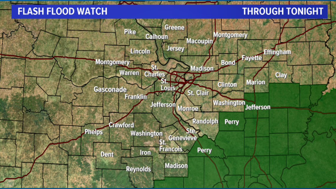
All of that rain is prompting a flash flood watch for areas farther south.