
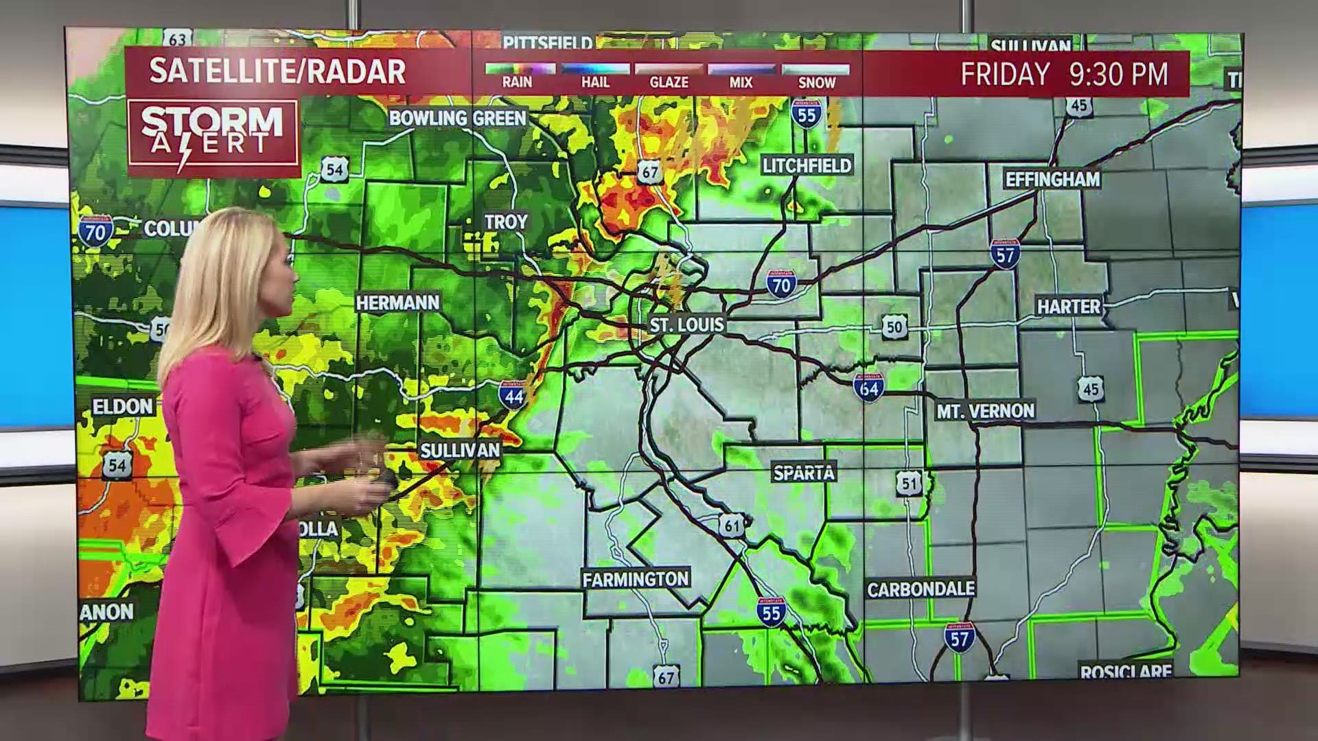
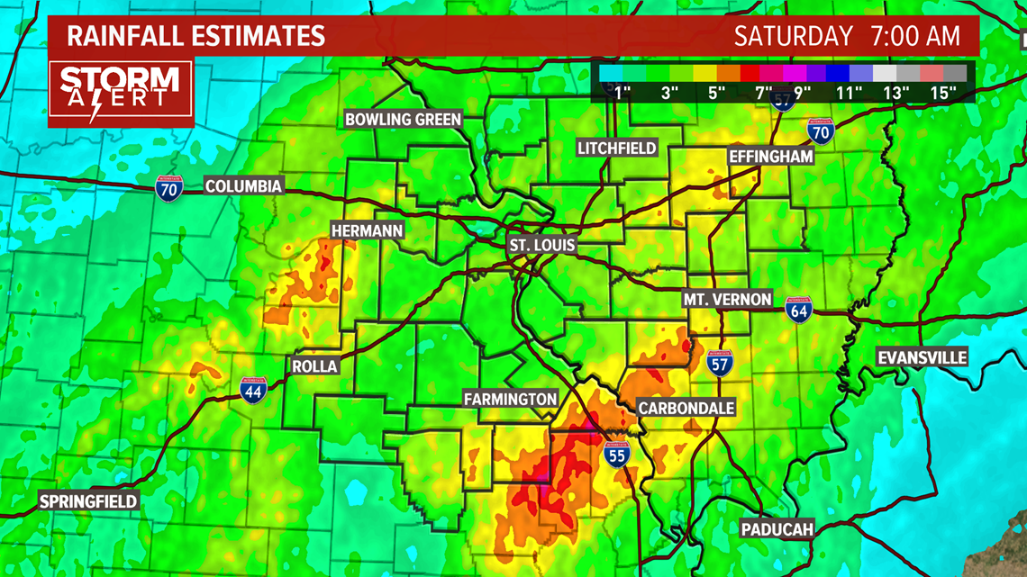
ST. LOUIS — Heavy rain and strong thunderstorms pounded the 5 On Your Side area overnight Friday. Rain will wrap up Saturday, turning lighter by late morning. Some areas received over 4 inches of rainfall, nearly everyone received 2 inches.

RELATED: Live interactive radar
Now that the heaviest rainfall and the storms are behind us, flash flooding won't be a big issue, but areal flooding will. At times, Friday night's storms dropped rain at a rate of close to 7 inches an hour. The heavy rain rapidly overwhelmed area creeks, streams and drainage areas. Ponding and localized flooding will continue to be a problem.
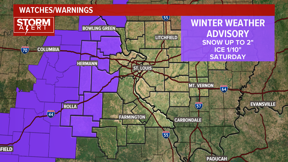
As forecasted, rain will shift to snow this afternoon and evening. Snow impacts will be minimal for the St. Louis metro area, most spots will only see trace to 0.5 inches of snow and a little ice.
There is a winter weather advisory for Gasconade, Montgomery, Phelps, Dent, Crawford, Franklin, Warren, Lincoln and Pike counties. Those areas could see up to 2 inches of snow and 1/10 inch of ice.

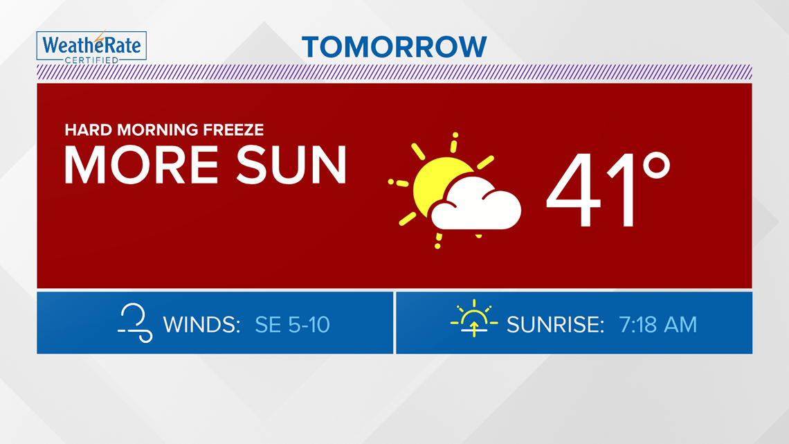
A hard freeze will hit overnight Saturday as lows drop into the mid 20s. Driving conditions may be slick Sunday morning. If you have to drive west, plan to drive in snow.

Download the free 5 On Your Side app to get the latest watches and warnings and track conditions live with our interactive radar. Use the links below to download now.
5 On Your Side news app
iPhone | Google Play