
ST. LOUIS — After the sunset following a gorgeous Thursday in St. Louis, changes are beginning to take shape in our weather pattern as we head into the weekend and next week.
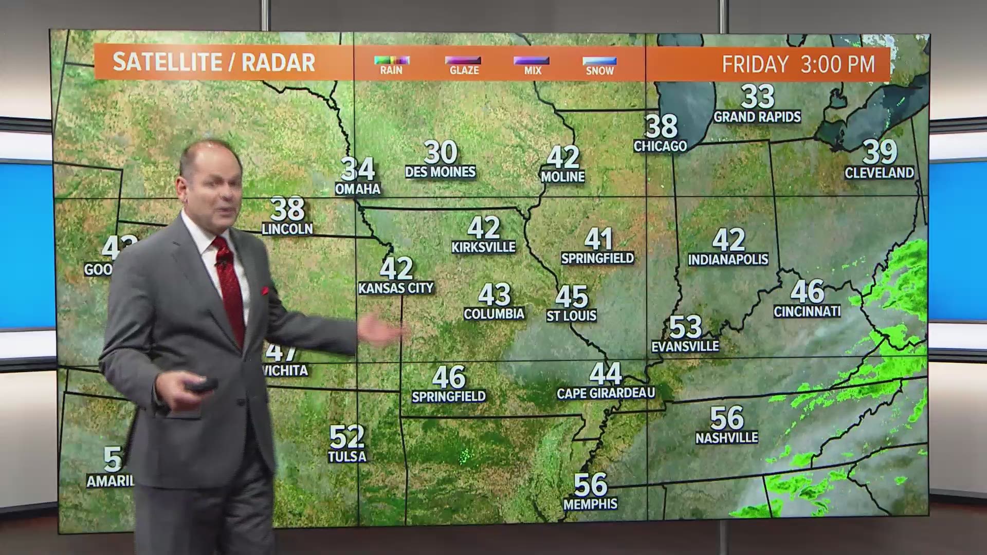
A relatively weak system passed by to the south of the metro area overnight Thursday and early Friday. The rain showers with this system stayed to the south of St. Louis and in areas that did see rain, amounts were quite light.
After climbing above the 60-degree mark Thursday, Friday and Saturday will be close to average for this time of year with highs in the 40s. The weather pattern really begins to shift by Sunday into Monday. Initially, it means another brief spell of warmer weather Sunday afternoon and early Monday before arctic air spills south into the region Monday night into the middle of next week.

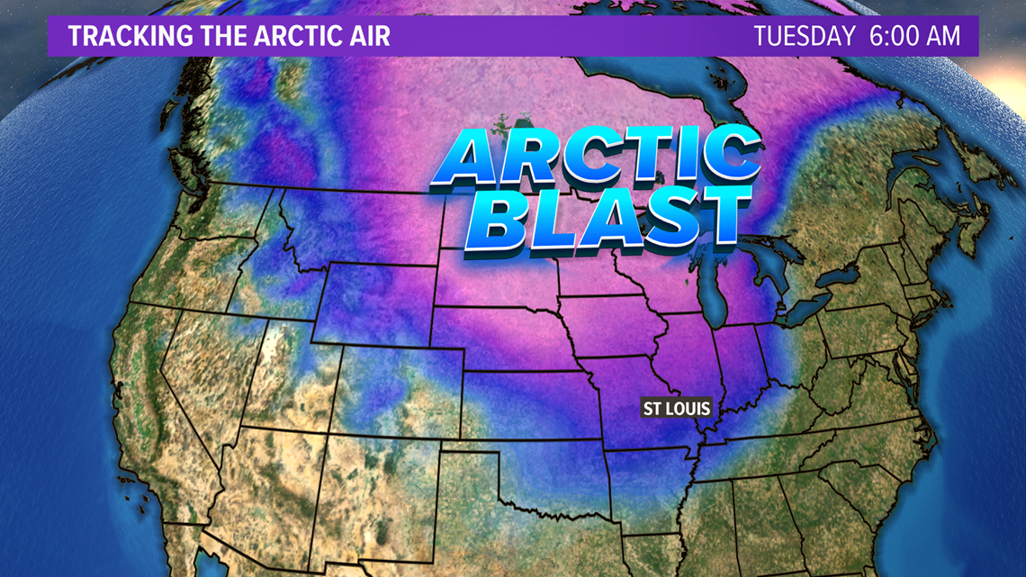
Temperatures on Tuesday into Thursday may be more than 10 degrees below average for this time of year with highs struggling to reach freezing in some areas.
Download the free 5 On Your Side app to get the latest watches and warnings and track conditions live with our interactive radar. Use the links below to download now.
5 On Your Side weather app
iPhone | Google Play
5 On Your Side news app
iPhone | Google Play

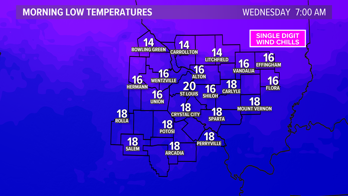
Overnight lows will be in the teens for most of us by Wednesday morning. Add in the breeze and you have a biting wind chill in the single digits.
While it may warm a few degrees into next weekend, the below-average temperatures are expected to continue. So far, the consensus among the computer models and looking at similar patterns in the past would indicate that any snowfall would be minor, if at all even though it appears to be favorably cold.