
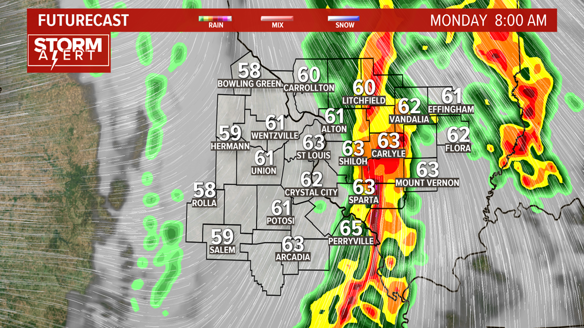
ST. LOUIS — A line of showers and storms moved through the bi-state early Monday morning.
A tornado watch is no longer in effect for our area.
Isolated severe storms are possible as this system swings through. The main concerns for the St. Louis area are strong wind gusts. Farther south and southwest, isolated tornadoes could develop along the line of storms.
Download the 5 On Your Side app to get weather alerts, watches and warnings sent straight to your cell phone or tablet.
5 On Your Side weather app
iPhone | Google Play
5 On Your Side news app
iPhone | Google Play
The line of storms with heavy rain and gusty winds will move into the 5 On Your Side viewing area between 3 a.m. and 8 a.m.

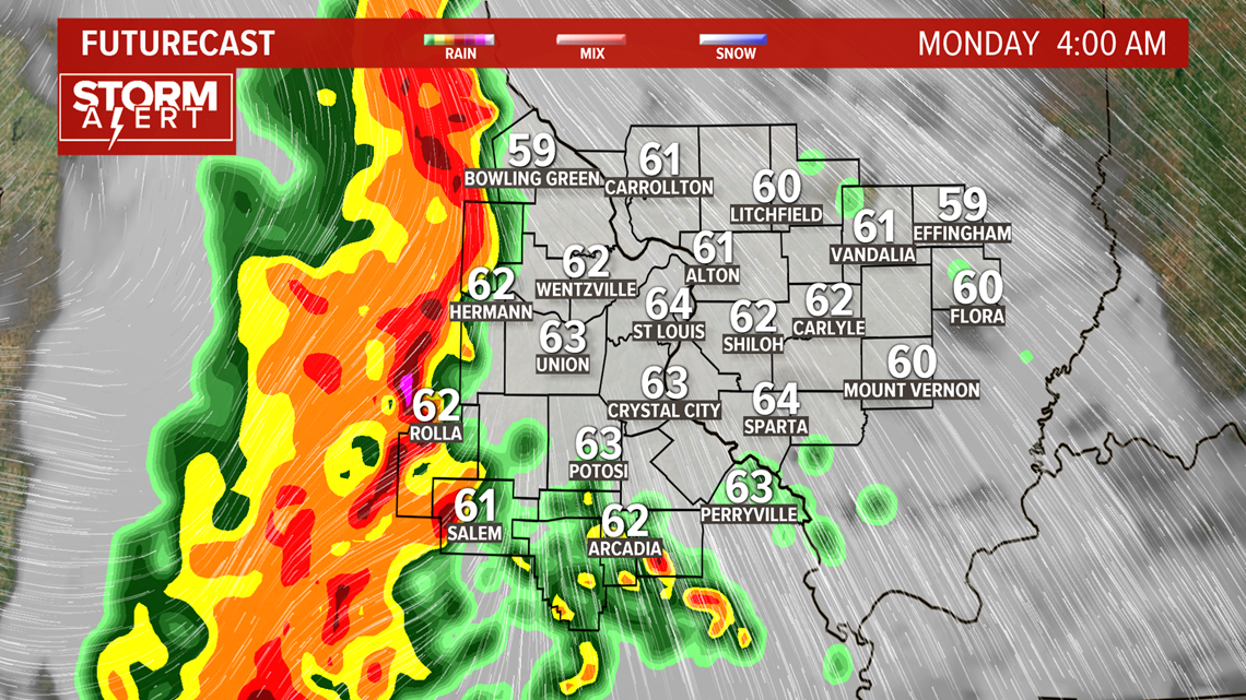
Most of the metro St. Louis area will see the gusty thunderstorms just as the Monday morning rush hour gets underway.

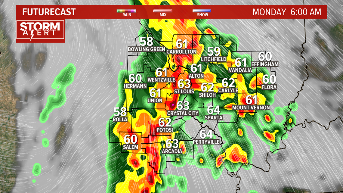
The line of strong storms will shift farther east during the morning.
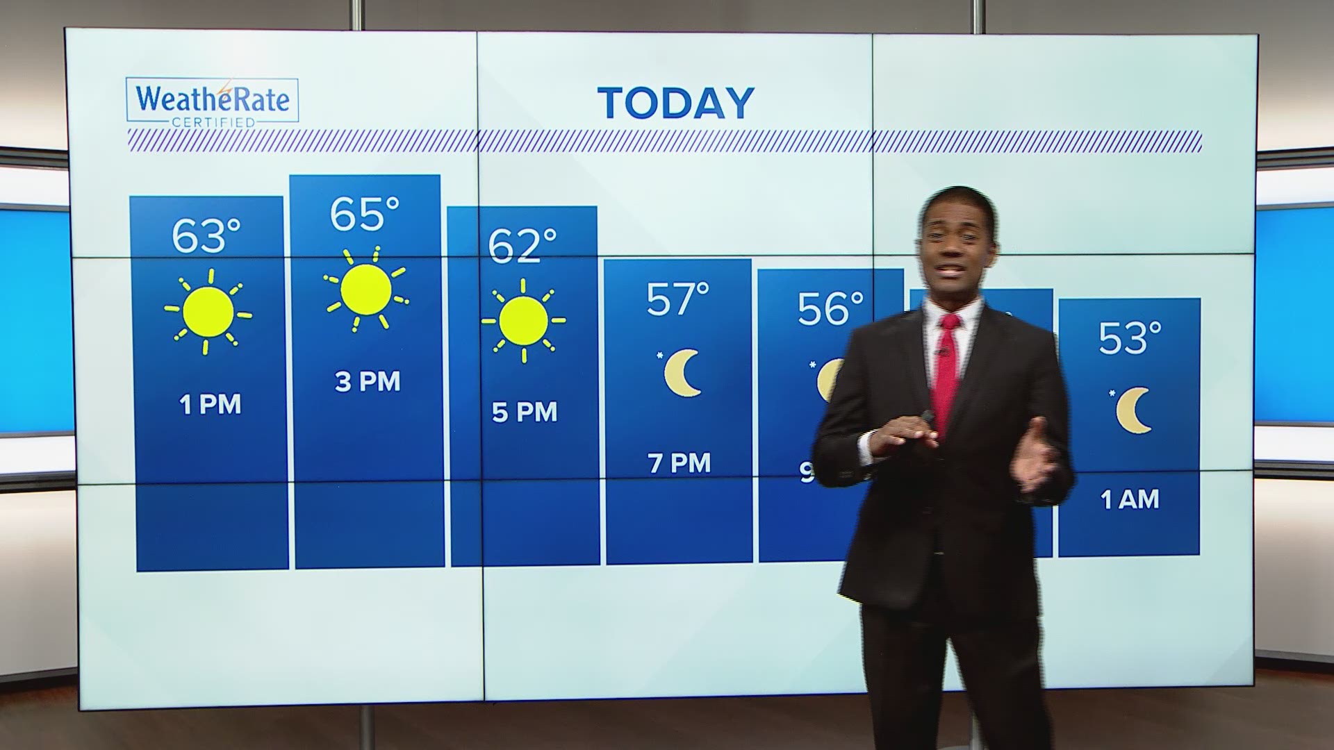
As the morning rain ends, strong winds will pick up. Breezy conditions will continue through Tuesday with gusts both afternoons above 30 mph possible.
Sunshine will return to the area during the afternoon.
RELATED: Live interactive radar